
For exporters and cooperatives
Read every plot's forest history before your EU buyer asks
The EU deforestation rule asks for each plot's location, proof it was not cleared after 31 December 2020, and proof it was produced legally, which includes the rights of the people who hold or use the land. TERRA reads each plot against the forest map the EU published for the rule. In Brazil and Colombia it also reads the national registers of indigenous and community land.
TERRA is in private beta, and places are limited. A member's invitation code lets you in at once; without one, ask for a place.
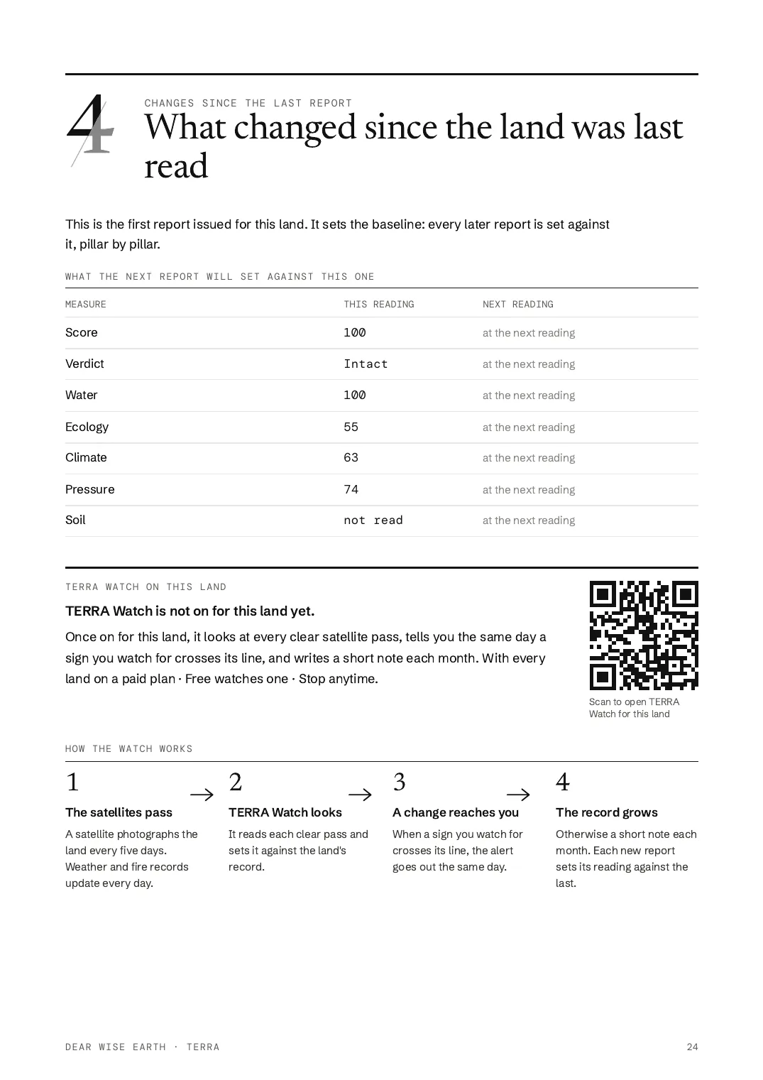
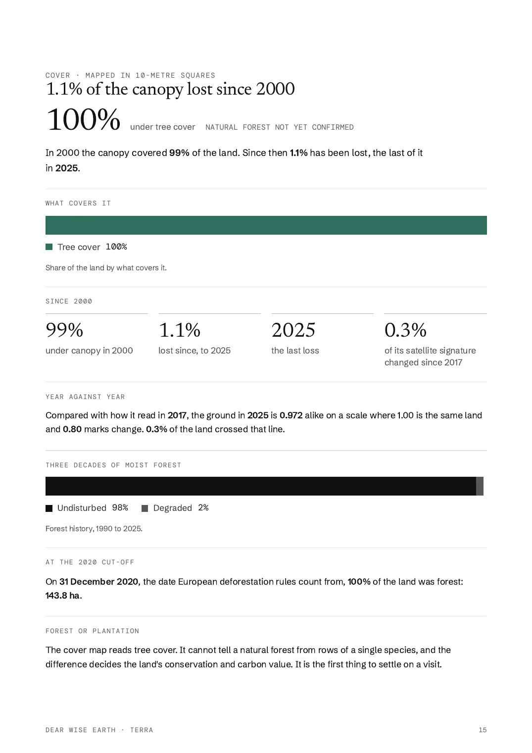
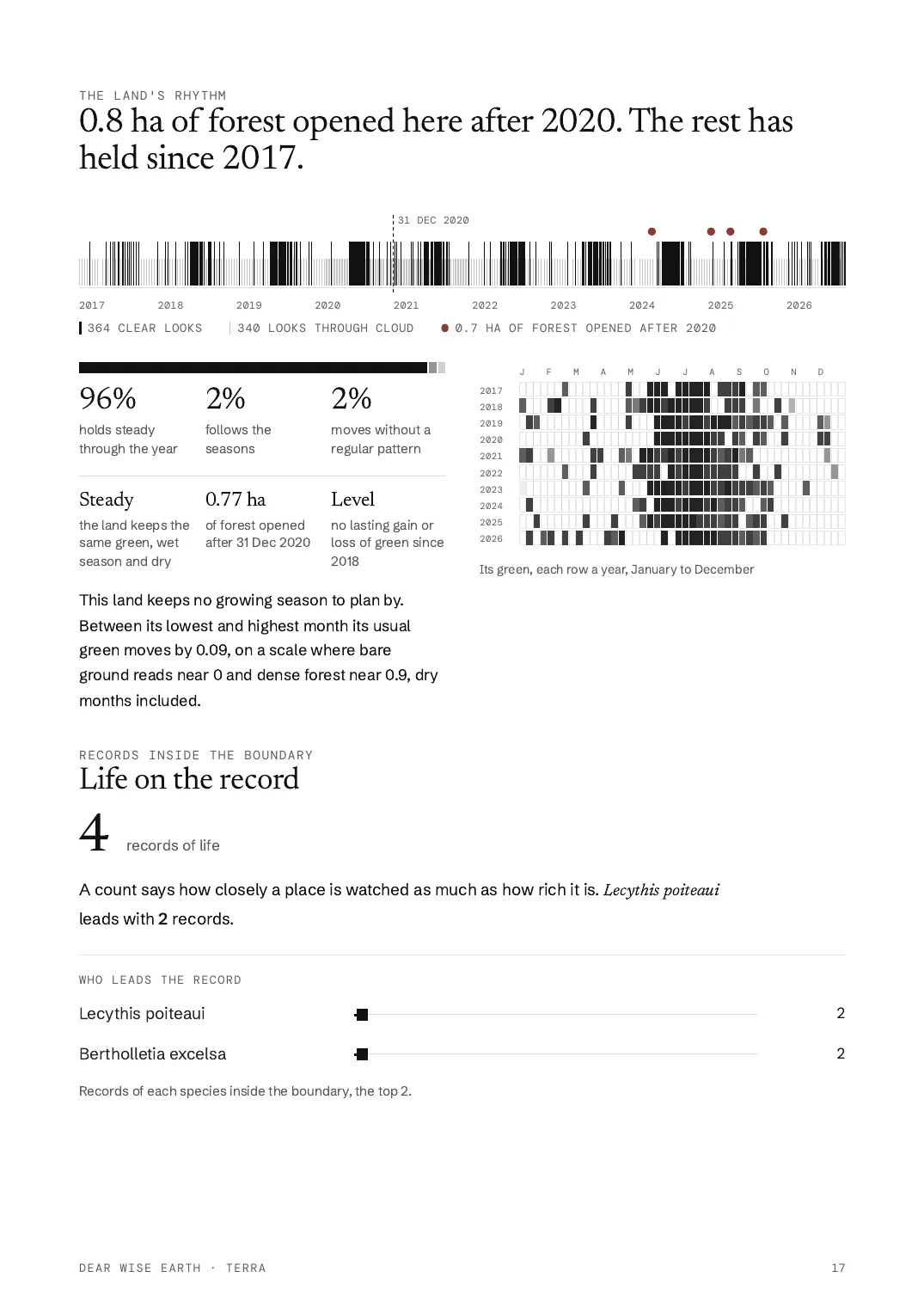
Pages from the TERRA report
What goes wrong
01
The buyer holds the law and the cooperative pays for it
A Fairtrade network study found the cost of the EU rule pushed down to producers. One Peruvian cocoa cooperative spent USD 60,000 to 100,000 on it.
TERRA answers itUp to 50 plots on one Professional account, and larger files priced by the file.
02
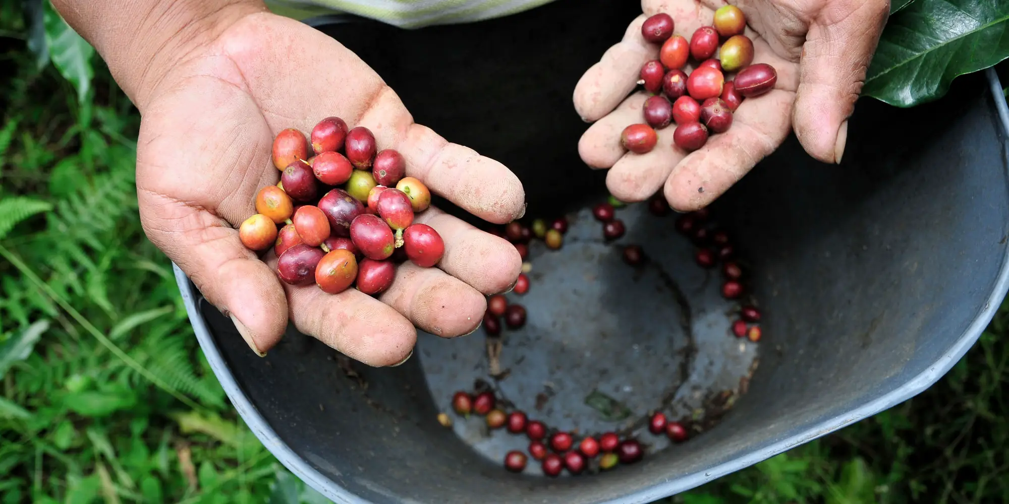
The EU map calls shade coffee forest
The EU's own accuracy check of its 2020 forest map found that 18% of the land it mapped as forest was not. Coffee and cocoa under shade trees are easily caught.
TERRA helpsThe EU map beside the national records and the loss year by year, so a false flag can be answered.
03
Legality includes the land rights
The due diligence statement covers the rights of the people who hold or use the land, and many smallholders farm without a title.
TERRA helpsIn Brazil and Colombia, every plot read against the national registers of indigenous and community land.
04
Every plot, every season, by hand
Checking plots one by one ties up the person who also runs the books, the buyers and the harvest.
TERRA answers itAll plots in one table, each with its forest record and its dates, read again when you ask.
What TERRA does not do
TERRA does not map the plots, file the due diligence statement or certify anything. It reads the plots you have and gives you the evidence.
How TERRA reads the land for you
The forest record since 2020
Whether any tree cover on each plot was lost after 31 December 2020, free on every plot's reading and in one CSV for all your plots with Pro.
See it on a plot in the Amazon, Brazil →- 01Tree cover in 2000
- 02Loss since 2000, as a share of the plot
- 03The latest year the plot lost tree cover
- 04Any loss after 31 December 2020, yes or no, left blank when the record did not answer
- 05Overlap with a protected area
- 06Indigenous or community land on the plot's reading, from the national registers in Brazil, Colombia and Costa Rica
- 07Clearing alerts after the yearly record ends, where they reach the plot, with the days they cover
What you will use
Only what your decision needs.
Forest and its history
Canopy in 2000, the share lost since, the last year of loss, and forest on 31 December 2020 by the EU's own map.
Protected and community land
Protected-area overlap on every plot. In Brazil, Colombia and Costa Rica, indigenous and community land from the national registers too.
Your portfolio
Your plots on the Earth and in one table, with a CSV of each plot's score and five pillars. The forest columns come with Pro.
Private readings
Read supplier plots where only you can open them. Nothing is published unless you choose.
Ask across your lands
Ask which plots carry the most clearing alerts or the least tree cover, and see them ranked with the figure beside each.
Risk across your lands
The full export, up to 100 plots a file: canopy in 2000, loss since, last loss year, loss after 2020, alert coverage, protected overlap.
Read again
After each harvest, read a plot again on the same boundary and see what changed since the last reading.
Reports
A dated, signed PDF for your buyer. On screen, the report also saves the plot as GeoJSON for the EU's information system.
Volume
Send the cooperative's plot file and every plot comes back read, one row each, in one table.
Later, when you need itTERRA Watch · Your name on the reading
What TERRA reads for you
- Forest on 31 December 2020, on the EU's mapPer plot
- Clearing since, year by yearPer plot
- Clearing after 2020 flaggedPer plot
- Inside indigenous or community landBrazil, Colombia
- Inside a protected areaPer plot
- All plots in one tablePortfolio, CSV
Before you start
Is this a certificate?
No. It is evidence for your due-diligence statement. The EU's 2020 map is one reference and not binding, so the reading shows it beside the national records. The statement and the legal duty stay with you.
Forest in 2020 from the map the EU published for the rule. Tree-cover loss from the satellite record, year by year to 2025. In Brazil, the government's yearly clearing record. Each reading prints the dates its forest record covers and marks any record that did not answer.
Your portfolio
Every plot in one table, for your due-diligence file.
Your portfolio holds your plots on the Earth and in one table, each read on its own boundary. With Pro, the CSV export carries one row per plot: tree cover in 2000, loss since, the latest year of loss, any loss after 2020 and protected-area overlap. An unread value is an empty cell, never a zero.
Open the worked portfolio →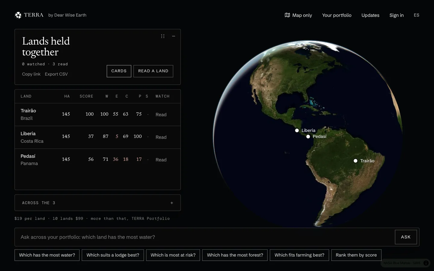
Exporters and cooperatives
Read your first plot in private, then add the rest to one table.
TERRA is in private beta, and places are limited. A member's invitation code lets you in at once; without one, ask for a place.